Designing a Malibu Hillside Driveway With 3D Grading Models
A vacant Malibu lot off Pacific Coast Highway sits on a 22% slope. Here's how we used 3D terrain models to fit a 15% fire access road with minimal grading.
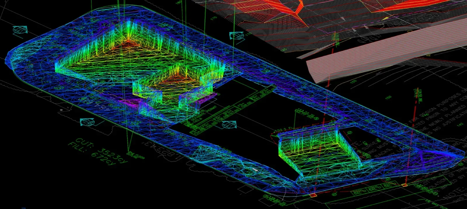
Some lots you design around. This one you design up.
We started a new project in the City of Malibu on vacant land off Pacific Coast Highway. No house, no driveway, no utilities. Just a steep hillside lot waiting for someone to figure out how to build on it. That’s the fun part of the job, and it’s also where 3D grading models earn their keep.
The Lot: 22% Average Slope Above PCH
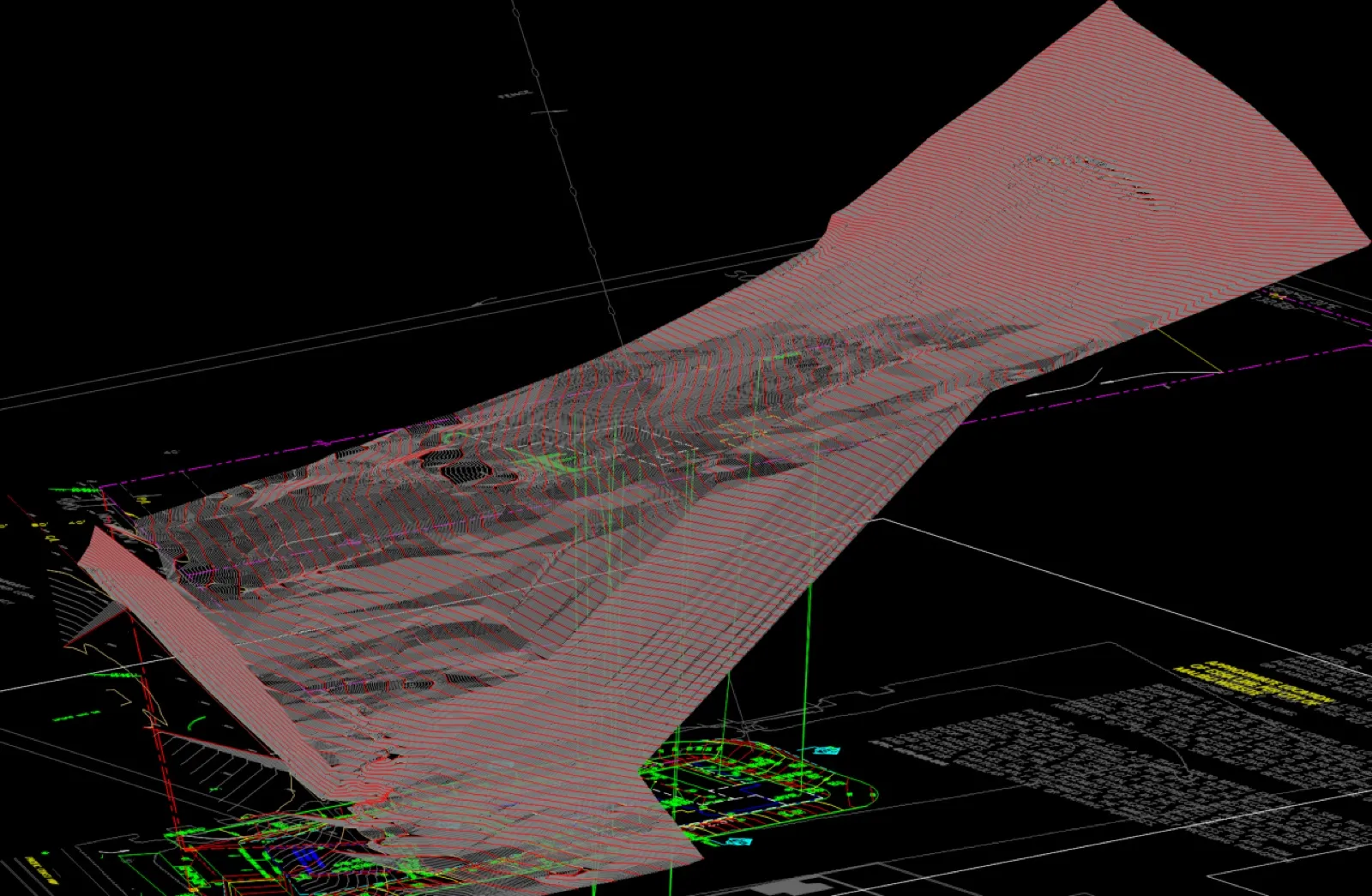
The existing conditions model above is where every hillside project starts. Within the construction limits, the ground slopes upward away from PCH at about 22% average. On paper that sounds manageable. Standing on it, you feel it in your legs.
For comparison, a typical suburban lot might have a 5% cross slope. Los Angeles County considers anything over 20% steep enough to trigger hillside review. This lot lives in that range for its entire buildable depth, so every alignment decision matters.
The Design: Fire Access Around a Basement and Two Pools
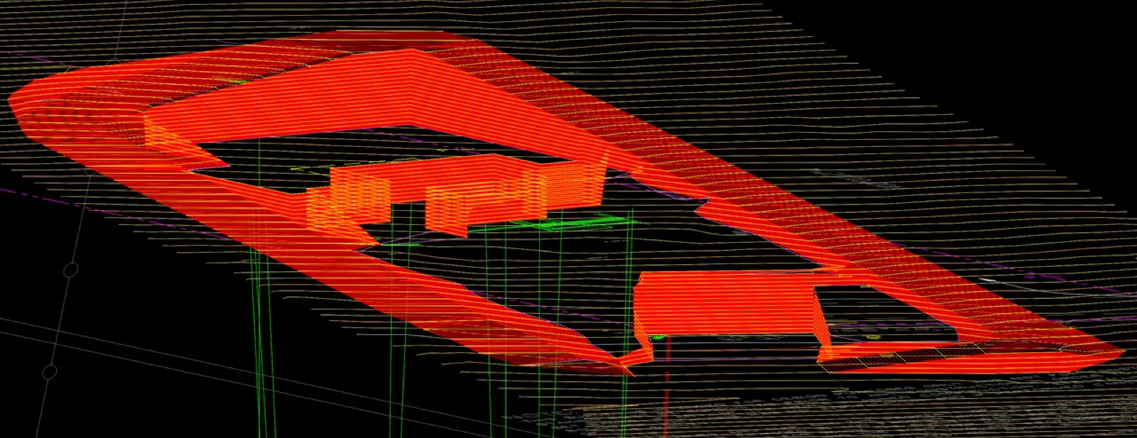
The proposed model shows where this is headed. The driveway connects through the neighbor’s driveway at the very bottom of the lot, about 13 feet above PCH. That bottom pad holds a large garage.
Here’s the layout from there. On either side of that garage, a fire access road, which doubles as a driveway, circles the new house. The house itself has a basement and two pools. On the west side, a second garage sits underneath the main structure and leads down to the basement.
The Slope Problem: 22% In, 15% Out
The average grade from the bottom of the lot to the rear fire access road is 22%. Our target was a fire access road at 15% maximum with as little grading as possible.
Those two numbers don’t reconcile on a straight line. A straight shot up the hill means deep cuts on one side and tall fills on the other, plus retaining walls to hold them. So we did what the contours told us to do. The road slightly cuts and fills along the way, following the existing terrain instead of flattening it.
The other constraint was the 2:1 daylight slopes. On a hillside, every cut and fill needs to daylight, meaning slope back to existing grade at 2 horizontal to 1 vertical, before it touches a property line or the natural terrain. We kept those daylight lines as tight to the road as possible. Every foot of daylight slope is a foot of disturbed hillside, and disturbed hillside means erosion control, plantings, and plan check comments.
Checking the Numbers: Excavation Model First
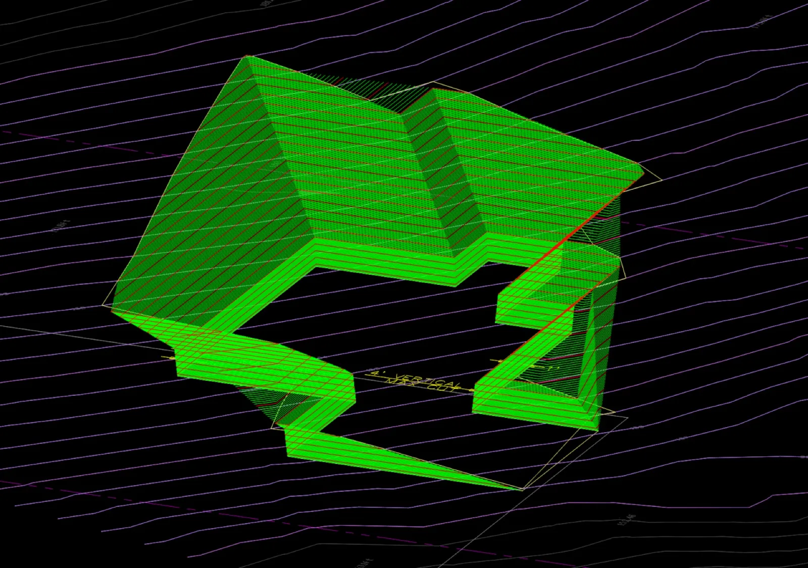
Once the design was in place, we modeled the excavation on its own before touching the full site. That model above shows the cut surface in green with the retaining wall benching visible in the stepped contours. It answers one question: how many cubic yards of dirt come out of the hill for the pads and road alone?
Then we ran the elevation analysis with a spectrum color scheme, which paints the terrain from blue at the low end to red at the high end.
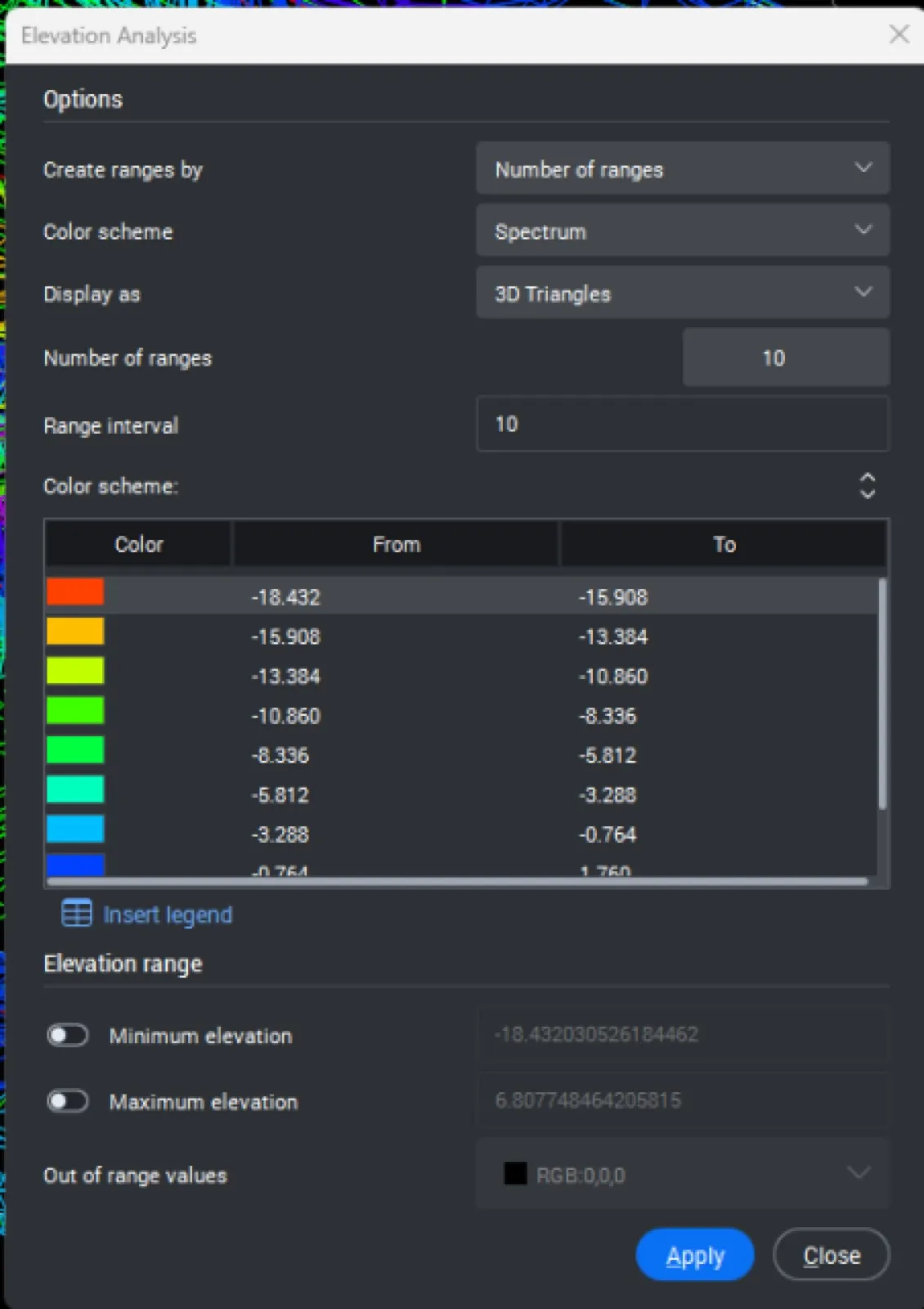
That dialog is the setup behind the color map. Ten ranges, spectrum scheme, and the software triangulates every surface triangle into its bin.
The Full Grading Balance
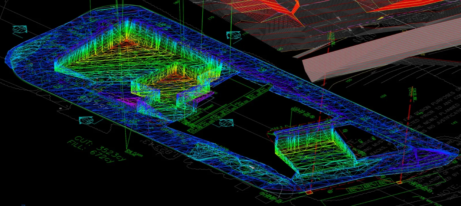
The image at the top of the post is the payoff. Full grading plan modeled, cut and fill totaled across the whole site. The spectrum view makes the high cuts and high fills obvious at a glance: red where the road benches into the hill, blue where fill goes in below.
Balancing cut and fill on a site like this is the whole game. Hauling dirt off a Malibu hillside is expensive, and importing it is worse. The closer the numbers land to even, the cheaper the grading phase. Following the contours kept the balance tight without walling the project in.
What a Model Buys You
None of this shows up in a 2D plan set until the contractor’s blade hits dirt. The 3D models caught the grade breaks, the wall heights, and the yardage counts while they were still free to change. On a 22% lot in Malibu with a fire access requirement, that’s the difference between a grading plan that passes and one that comes back with comments.
This one is early. Design is in, quantities are checked, and the model says the numbers work. Next stop is the plan check submission.
If you’ve got a steep lot in Malibu or anywhere in the Los Angeles hills, this is the process. Model it before you grade it.
Frequently Asked Questions
Related Portfolio Projects
Related Posts
Silver Lake Hillside Driveway looking for Optimum Route
Finding a clean driveway path on a steep Silver Lake hillside lot: a driveable route with a turnaround in front of the house, on tight existing grades.
Hillside Grading and Drainage for Los Angeles Luxury Homes
Los Angeles hills from Bel Air to Malibu demand careful hillside grading and drainage. Here's what building on these slopes requires.
Why Drainage Plans Matter on LA Hillside Homes
Los Angeles hillsides from Pacific Palisades to Beverly Hills bring views and slope challenges. Here's how drainage plans manage water on hillside lots.