W Mariposa Drainage Plan - From Existing Conditions to Final Design
How we designed a drainage plan for an Altadena fire rebuild, starting with existing survey data, tying into neighbor elevations, and setting up flowlines to gravity drain to the street.
When we first pulled up the survey for the W Mariposa property in Altadena, we could see the lot had been significantly changed. The Army Corps of Engineers had come through after the Eaton Fire to clear the structure, and in doing so, they slightly excavated the site. That excavation changed the existing grade, which meant we could not just rely on old survey data. We had to account for what was actually there now.
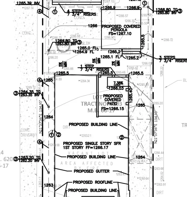
Starting With the Existing Conditions
Our first step was to tie into the existing elevations along the neighbor’s property lines. Since the lot had been regraded by the Army Corps, we needed to understand exactly what the current topography looked like before we could design anything.
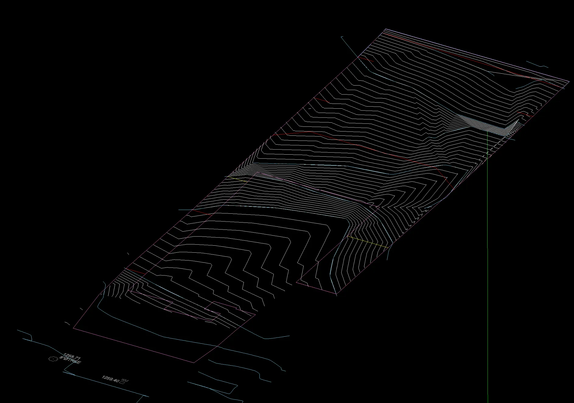
The existing conditions showed us the slope running from rear to front, with the neighbor’s property line elevations giving us our starting points. We used those elevations to establish our baseline and work backward toward what the finished grade would need to be.
Setting Up the Proposed Design
Once we had the existing elevations locked in, we started setting up the proposed conditions. The key was establishing the ADU finished floor elevation first. That is the anchor point for everything else. From there, we worked our way down to the main house and set its finished floor.
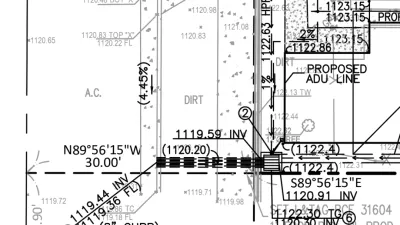
With both finished floors established, we needed a path for water to gravity flow off the lot. We picked the rear corner of the building and moved 10 feet away, keeping the minimum 5% slope required for flowlines. From that point, we designed flowlines that would collect water and direct it through area drains, then into pipes that gravity flow toward the front of the lot.
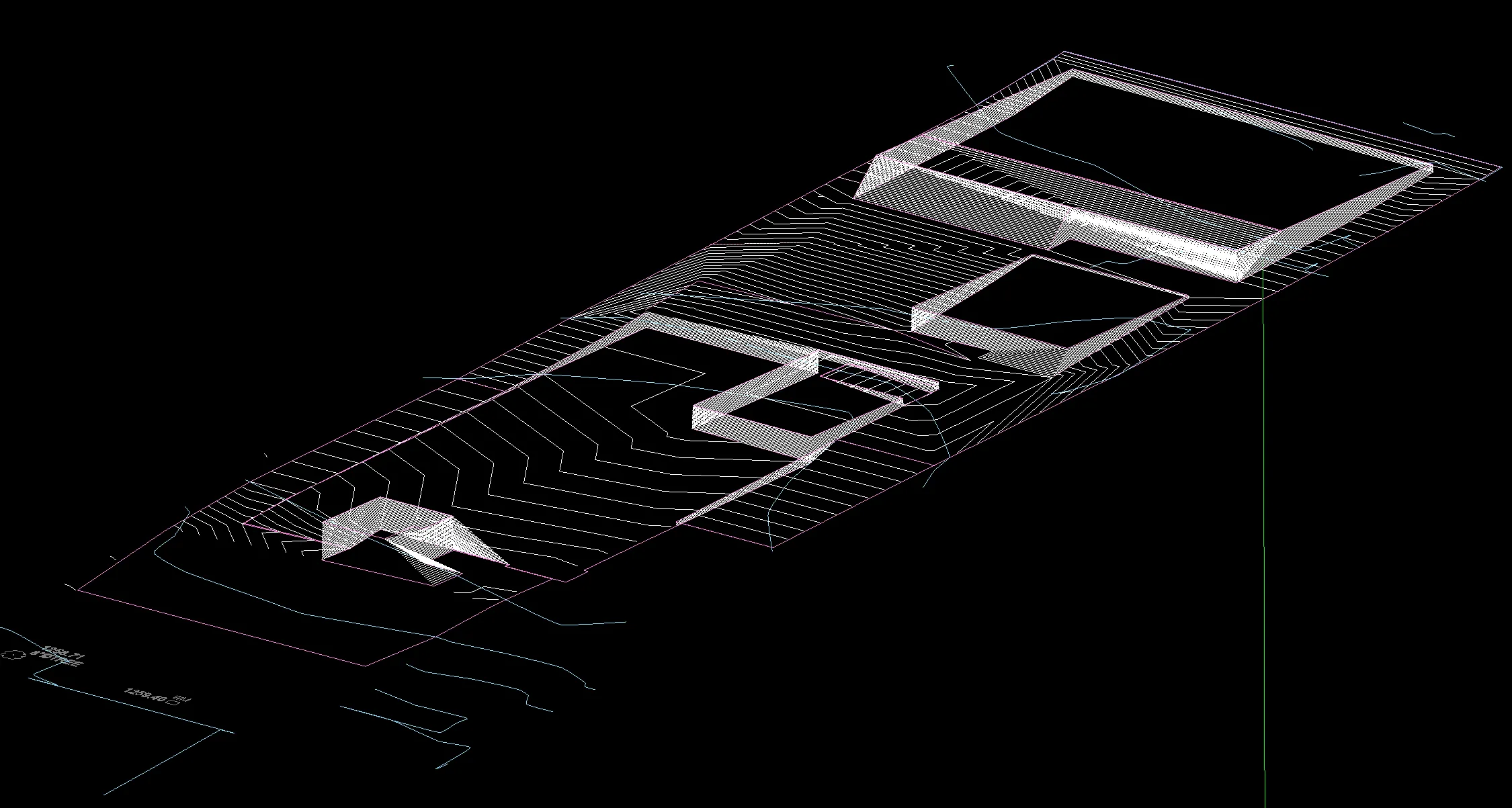
The proposed model shows how everything connects. From the rear corner flowlines collecting water, to the area drains picking it up, to the pipes running under the proposed hardscape and exiting at the existing driveway wall.
The Final Plan
The completed design shows the full drainage plan with all flowlines, area drains, and pipes coordinated with the proposed topography. We had the retainer come in on a Friday with the existing survey data, and by Sunday night we had a fully designed plan ready to submit. Being able to turn work around that fast comes down to having a clean survey from a good surveyor and a well thought out set of architectural plans. When those pieces are in place, the drainage design practically lays itself out.
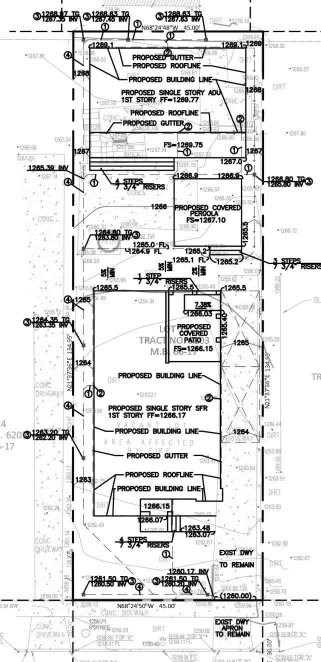
The plan coordinates with the existing driveway grade at the street, ensuring stormwater exits the property without issue. For this Altadena fire rebuild, getting the drainage right meant understanding what the Army Corps left behind and designing from the actual current conditions. Not assumptions based on old surveys.
If you are rebuilding in Altadena and need drainage plans, get in touch. We can help you work through the existing conditions and get a plan together for LA County submittal.
Related Portfolio Project
Residential on West Mariposa Street
Drainage Plans for fire rebuild.
View the full projectYou Might Also Like
Rebuilding Altadena
Altadena first lot since the Eaton Fire, was sold recently on Calaveras Street for $100k above listing. Location and price wise this seems low to me, but also the buyer will have to wait a while before anything can happen.
Altadena and SB9
Was doing some networking this week and getting to chit chat with Architects and developers about the fires has been most interesting.
Grading and Drainage Solutions for Altadena's Distinct Landscape
Altadena, tucked beneath the San Gabriel Mountains, is a charming Los Angeles County community known for its scenic beauty and charming homes. Unlike the steep hillsides of nearby areas, Altadena's flatter terrain presents its own set of grading and drainage challenges.